
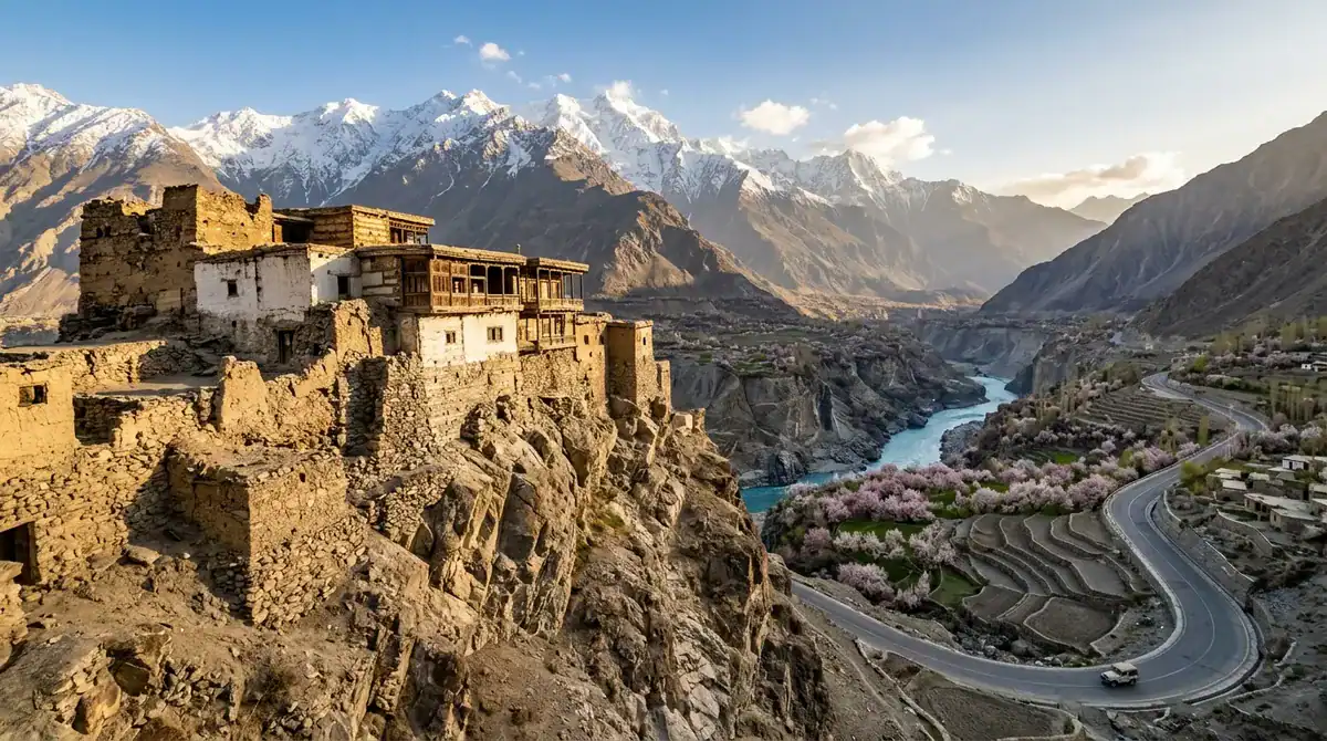
Hunza Valley is a mountain-and-heritage district in Gilgit-Baltistan, northern Pakistan, covering 11,695 square kilometres of royal forts, glacial lakes and terraced villages along the Karakoram Highway. For a Hunza Valley travel guide, the short answer is this: start with the Baltit and Altit forts, the turquoise water of Attabad Lake and the sunrise views above Duikar, then plan your days around the road that links them. The official Hunza guide measures distances from Aliabad, the reference point most travelers use. Baltit Fort is 7 km away, about 20 minutes by car or jeep, while Attabad Lake sits 28 km out, roughly 42 minutes.
Timing and permits shape this trip more than most travelers expect. The government’s trekking season runs May through October, restricted-area treks need a permit plus a licensed guide and porter, and the Khunjerab Pass, at 4,693 metres, closes during winter. Weather matters too. NDMA’s Monsoon 2025 damage tables record 15 houses and 2 bridges damaged in Hunza district, so check road conditions before you book a jeep or plan a day on the highway.
Key Takeaways
- We suggest giving the Karakoram Highway three days for its stops, or four to five days if you add Khunjerab.
- We recommend setting aside about two hours for Altit Fort, covering the guided tour, garden and living village walk.
- We suggest visiting Karimabad Bazaar earlier in the day, before clouds build over the peaks.
- We advise photographers to start the steep drive up to Eagle’s Nest Point in the dark for sunrise.
- We recommend a roadside stop at Rakaposhi View Point in Ghulmet, where the mountain is visible without any trekking.
Hunza Valley at a Glance: Where It Is and How to Reach It
Hunza is a mountain-and-heritage valley within Hunza District, in the Gilgit-Baltistan region of northern Pakistan. The district covers 11,695 square kilometres, and its cultural heritage includes royal forts, watchtowers, historic polo grounds, old mosques and the Sacred Haldekish Rocks in Ganish. Village life unfolds beneath glaciers and high peaks here, so you can spend a morning in a centuries-old fort and an afternoon beside a glacier-fed lake.
The valley has a simple layout once you know the reference points. Karimabad is the hub, the town where most visitors base themselves and set out for the forts and viewpoints. Aliabad is the point from which distances are measured, so when you see “7 km” or “28 km” in a guide, that is the number from Aliabad. Passu, for example, lies 50 km from Aliabad, about an hour and ten minutes by car or jeep. Upper Hunza and Gojal stretch further north, where villages sit farther apart and the road climbs toward the high mountain passes.
Most travelers reach the valley by road, and the Karakoram Highway is the thread that ties everything together. Viewpoints, lakes and villages are strung along it, so the road is more than transport. It is part of the scenery and sets the pace of your days.
That pace is the reason to plan buffer days. Mountain roads are narrow and driving is slow, so a distance that looks short on a map can take most of a morning. Weather can also close sections of road through landslides or damage to bridges. Build in spare days so a closed stretch of highway does not wreck your plans. If a jeep trip has to wait for the road to reopen, that extra day becomes a slower walk through the village instead of a missed sunrise.
Baltit Fort: Karimabad’s Royal Hilltop Landmark
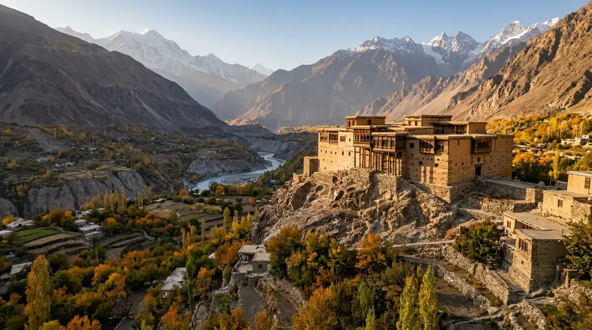
Baltit Fort sits on a hill above Karimabad, and the walk up is part of the visit. Leave the bazaar and climb through the old village lanes, which takes about 15 to 20 minutes. Karimabad is roughly 2,500 metres above sea level, so take the slope at an easy pace. Inside, a guided tour moves through rooms of household objects, weapons and carved woodwork over about 45 to 60 minutes.
The fort is a three-storey royal residence and museum, once home to the Mirs of Hunza. Its wood-and-stone architecture shows cultural links across the region, and its restoration made it an early conservation project in northern Pakistan. It is on UNESCO’s Tentative List, with a submission dated 30 January 2004, but it is not on the World Heritage List.
Climb to the rooftop terrace and the valley opens below you, with views of Karimabad, the Hunza River, Rakaposhi and the Nagar peaks. Expect wind up there, even on warm days. The steep paths and narrow internal stairs can be tough for some visitors. June to August is the busiest stretch, while winter is quiet, cold and sometimes snowy. Pair the visit with Altit Fort, 9 km from Aliabad, on the same day.
At a glance
- Best for: history lovers, photographers and families who want a short heritage visit with a view
- Best Season: April to October, when the Gilgit-Baltistan tourism department recommends visiting
- Entry Cost: Pakistani adult tickets were roughly PKR 500–1,000 in 2025 and 2026, with higher prices for foreign visitors; see the official profile for current rates
- Time Needed: about 90 minutes for the walk, the guided tour and the rooftop
- Access by Road: about 100 km from Gilgit via the Karakoram Highway to Karimabad, then a short uphill walk
Altit Fort: Restored Royal Seat and Living Village
Altit Fort is the place to slow down and read Hunza’s past. Set in Altit village, about 2 km from Karimabad, it is a short walk or a five-minute drive from town. A guided tour of the fort takes around 45 minutes. Add time in the garden and a walk through the historic village, and you have a full visit of about two hours. From Aliabad, the fort is 9 km away, roughly 28 minutes by jeep.
Hunza’s oldest monument was once a royal seat. The Aga Khan Trust for Culture restored it and reopened it as a heritage museum in 2007. The restoration keeps the fort as an empty shell, so you can see traditional seismic-resilient construction up close. The village around it is still lived in, so the walk takes you past working homes rather than a museum display.
For 2026, the official website lists entry at PKR 1,650 for international visitors, PKR 650 for national visitors and PKR 250 for visitors from Gilgit-Baltistan and Chitral, with a guide included. Daily hours run from 9:00 AM to 4:30 PM.
June to August is the busiest stretch, while winter brings quieter days and cold. Steep stairs and a cliffside terrace can be hard for some children and anyone with knee problems, and the uphill return walk from Karimabad sits at roughly 2,500 metres. Many visitors pair the fort with Baltit Fort on the same day.
At a glance
- Best for: photographers, history lovers and slow travelers
- Best Season: April to October
- Entry Cost: tiered by visitor type for 2026, with a guide included in the ticket
- Time Needed: about two hours for the fort, garden and village walk
- Access by Road: 9 km from Aliabad, about 28 minutes by jeep
Karimabad Bazar: Shopping, Cafés and Sunset Views
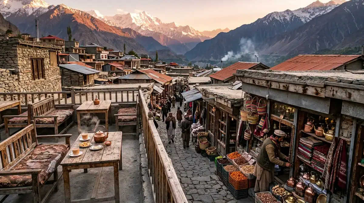
Karimabad Bazaar is the commercial heart of the town, a short walk from Baltit Fort, so most travelers pair the two in one easy afternoon. It is a compact, tourist-oriented market rather than a historic caravan route. Its appeal is local products and easy access. Shops sell woollen goods, caps, dried fruit and jewellery, and it is worth asking where each piece was made.
Between purchases, stop at one of the cafés and wander the hillside streets. Karimabad sits at about 2,500 metres, above the Karakoram Highway, so take the climbs slowly. Rakaposhi, Diran, Golden Peak and Ultar Peak are all visible from town. A local Karimabad Bazaar guide recommends visiting earlier in the day, before clouds build over the peaks, but many visitors stay for the warm light that settles on Rakaposhi near sunset.
The market gets busier in the afternoon and near sunset, and it is at its liveliest on summer evenings. Winter is a different story. The same guide notes that the cold season brings many hotels and shops closing or slowing down, so plan your visit between April and October. Gilgit is about 102 km away by road. Vans run to Aliabad, and local taxis climb the roughly 9 km from there to Karimabad.
At a glance
- Best for: shoppers after local products, café stops and casual photography
- Best Season: April to October, as a visitor guide recommends; winter is cold and many shops close or slow down
- Access by Road: about 102 km from Gilgit; vans run to Aliabad and local taxis go up to Karimabad, about 9 km from Aliabad
- Suitable For: shoppers, casual photographers and families looking for an easy outing
Duiker Hill: Village Walks Above Karimabad
Duikar, also called Eagle’s Nest, is a traditional mountain village about 15 km above Karimabad, at roughly 2,850 metres. Its lanes wind between houses and terraced fields, and the walk is slow and easy to enjoy. You can wander at your own pace and watch village life go on while the Karakoram peaks rise around you.
Many guides list the viewpoint over Lady Finger Peak among their favourite lookouts above the valley. Getting there is simple. A steep paved mountain road climbs from Karimabad in about 30 to 40 minutes by car or jeep, and the tourism department advises traveling in daylight. If you want to earn the view, the walk from Altit Fort is a medium-grade, five-hour return hike through hamlets and steep terraced fields, reaching about 3,000 metres. Ask a local guide about the route if you are unsure of the way.
Expect cooler air than in Karimabad, so pack warm layers. The official tourism guidance recommends April to October, since winter access may be limited. Photographers gather at the viewpoints, so the village is quieter than the valley floor, but it can fill up near sunrise. For current details, see the official Duikar listing.
Duikar suits photographers, slow travelers and anyone who wants village life with mountain scenery. Locals speak Burushaski and Wakhi, and English and Urdu are also widely spoken.
At a glance
- Best for: village walks, panoramic photography and mountain scenery
- Best Season: April to October
- Time Needed: one to two hours for a viewpoint visit
- Entry Cost: no published fee for the ridge, according to one regional travel listing
- Access by Road: steep paved road, about 30 to 40 minutes from Karimabad by car or jeep, in daylight
Eagle’s Nest Point: Sunrise and Sunset Over Hunza
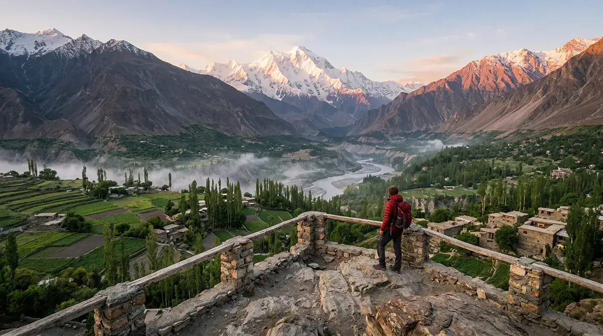
Eagle’s Nest Point is the village viewpoint at Duikar, and the whole visit is built around the edges of the day. Photographers set up for sunrise, when light spreads across the Hunza and Nagar valleys and reaches the Karakoram peaks. They return for sunset, when the ridges turn gold, and after dark the sky is good for stargazing. Between those moments, a slow walk through the village lanes fills the hours.
The outlook is wide and high, and it feels very different from the forts and lakes below. Views run over Hunza and Nagar toward the Karakoram range, and the settlement itself is small, with only a few homes and hotels. The viewpoint sits beside Eagle’s Nest Hotel, so an overnight stay puts you right at the edge of the scene when the light changes.
Plan around the road. The drive up from Karimabad is steep and paved, but it has sharp turns that call for careful driving, so give yourself time. For sunrise, that means starting in the dark. If you stay for sunset, think about the descent before the light fades, or book a room and walk down the next morning. In winter, the peaks can carry snow, but access is limited and the air is colder than in Karimabad, so April to October is the more comfortable window.
Eagle’s Nest suits photographers, stargazers and travelers who want a quiet night in the hills, as well as slow travelers who like village life with mountains at their doorstep.
At a glance
- Best for: sunrise and sunset photography, panoramic views and stargazing
- Best Season: April to October
- Suitable For: photographers, stargazers and travelers who want an overnight stay in the hills
Karakoram Highway: The Road Trip That Links Hunza
The Karakoram Highway, known as N-35, is a mountain road through Hunza and Gilgit-Baltistan. It links the region with the rest of Pakistan and continues north toward the China border. Many travelers treat the road as an itinerary in its own right, with stops at roadside viewpoints such as Rakaposhi, detours to Attabad Lake, and slow drives through upper-valley villages where terraced fields climb toward the peaks.
Allow time for all of it. Gilgit-Baltistan’s tourism advice is to leave room for photography and sightseeing rather than rushing between stops, and the Gilgit-to-Karimabad drive takes two to three hours. Rain, snow, rockfall and flooding can close sections of the road for a time, so read the travel safety advice from Gilgit-Baltistan’s tourism department before you set out each day. The best colour comes in mid-March to April for blossom and in October for autumn leaves.
This road suits photographers, overland travelers and anyone who enjoys the journey as much as the destination. Three days cover the highway stops around Karimabad, Attabad Lake and Passu, and four to five days let you add Khunjerab and a spare day for delays.
At a glance
- Best for: photographers, overland travelers and slow road-trippers
- Best Season: mid-March to April for blossom, October for autumn colour; June to August has the fullest access but is the busiest
- Time Needed: three days for the highway stops around Karimabad, Attabad Lake and Passu, or four to five days with Khunjerab
- Access by Road: the Karakoram Highway (N-35) runs from Gilgit through Hunza toward the China border
- Suitable For: photographers, road-trippers and history lovers who like the journey
Attabad Lake: Turquoise Water Beside the Highway
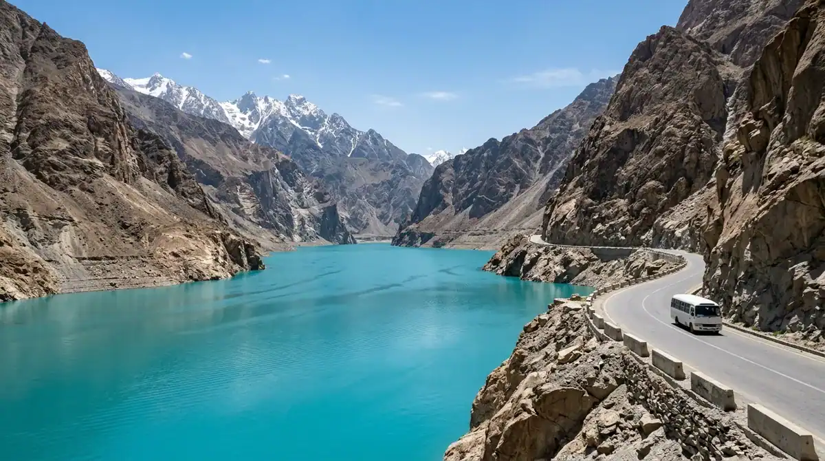
Attabad Lake is the valley’s signature pause, and its water is hard to forget. The turquoise lake spreads beside the Karakoram Highway in Gojal, Upper Hunza, where photographers gather for mountain-and-lake frames. Once you reach the shore, you can take a boat ride, try jet-skiing or cast a line for fishing. The official Gilgit-Baltistan listing names boating, jet-skiing and fishing among the lake’s activities.
The lake has a dramatic origin. A landslide on 4 January 2010 blocked the Hunza River, and the rising water submerged the old road, so the highway now runs through tunnels along the new shoreline. From Karimabad, the drive takes 30 to 40 minutes, while the 28 km trip from Aliabad takes about 42 minutes by car or jeep. The lake sits at roughly 2,500 metres, so expect a cool breeze even in summer. Pair the stop with the Attabad Tunnel and the Hussaini Suspension Bridge area, both close by along the road.
Crowds are the main thing to plan around. A July 2025 visitor review found the lakeside mostly crowded during peak season, so arrive early for quieter photos. April through October is the usual window, and September and October often bring stable weather, autumn colour and clear views. Allow about half a day, or a full day if you continue north to Passu.
Photographers will likely spend the longest here, and families will find it an easy lakeside outing. History-minded travelers can read the story in the landscape itself, where the road and the water tell the tale of the 2010 landslide. Slow travelers can make the lake the centrepiece of a relaxed day.
At a glance
- Best for: photographers, families seeking an easy lakeside outing and history-minded travelers
- Best Season: April to October, with September and October often favoured for stable weather and clear views
- Time Needed: about half a day, or a full day if continuing to Passu
- Access by Road: about 30 to 40 minutes from Karimabad along the Karakoram Highway, through the tunnels
Attabad Tunnel: The Drive Past the Lake
The Attabad Tunnels, also called the Pakistan-China Friendship Tunnels, are five road tunnels on the Karakoram Highway (N-35) beside the lake in Upper Hunza. The National Highway Authority’s tunnel listing puts their combined length at about 7.1 km, so a good part of the drive passes through solid rock.
You do not walk or stop inside the tunnels. Drive through at a steady pace, then pause at a safe lakeside pull-off or the landing once the road opens onto the water. These stops are where the photos happen: turquoise water, the steep slopes above the shore and, at some spots, a café or a boat ride.
The tunnels matter because of what happened before them. A landslide on 4 January 2010 blocked the Hunza River, formed Attabad Lake and submerged the old road. The tunnels restored the highway connection, so the drive itself tells the story of how the valley reconnected.
Travel time from Karimabad is roughly 30 to 45 minutes on the paved highway. April to May and September to October bring clearer views and fewer crowds than June to August, while winter can bring ice and delays on exposed sections. The road is narrow, so drive carefully and save your longest pauses for the lake.
At a glance
- Best for: road-trippers and photographers who want a dramatic drive with a lake stop
- Best Season: April to May and September to October
- Time Needed: one to three hours when combined with a visit to the nearby lake
- Access by Road: about 30 to 45 minutes from Karimabad on the paved Karakoram Highway
Hunza River: Turquoise Companion Along the Drive
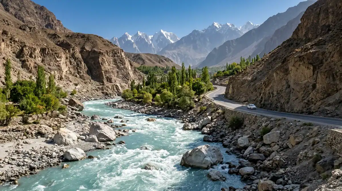
The Hunza River is less a single destination than a companion for the whole drive. It runs through the valley, and the Karakoram Highway follows its course past villages, orchards and steep gorges, so you will spend much of the day with its water in view. Pull over wherever a bend opens up a clear view and let the light on the water guide your photographs.
There is no gate, ticket booth or set visit length for the river itself. The official Hunza district page lists attractions such as Attabad Lake and the forts instead. Plan the river by the day instead, and stop when a view calls you. Mountain weather can change quickly, so a viewpoint that looks best in the morning may be better later, or on another day.
Where the river meets Attabad Lake, the stop becomes more active. The Gilgit-Baltistan tourism listing for the lake names boating, jet-skiing and fishing, so you can move from the roadside into the water and see the valley from a different angle.
This is a route for photographers and slow road-trippers, the travelers who like to stop often and let the journey set the pace.
At a glance
- Best for: photographers and slow road-trippers who want a river view at every bend
- Suitable For: photographers, slow travelers and anyone who enjoys the drive as much as the stops
- Entry Cost: no separate river entry fee is listed on the official district page
- Access by Road: alongside the Karakoram Highway, with no dedicated entrance
Rakaposhi View Point: Zero Point at Ghulmet
Rakaposhi View Point, also called Zero Point, sits at Ghulmet village in Nagar Valley, right beside the official tourism listing for the stop on the Karakoram Highway between Gilgit and Hunza. Pull over, step out and photograph Rakaposhi, its glaciers and the wide landscape around it. The peak rises to 7,788 metres, and the government tourism department describes an uninterrupted descent of about 6,000 metres from its summit to its base, so the view feels enormous from the roadside.
Many guides call Rakaposhi the queen of Hunza’s peaks, and here you can admire her without setting out on a trek. Glacier-fed streams run nearby, and in summer people relax beside the water and dip their feet in the cool current. The viewpoint has been fitted out as visitor numbers have grown. For the clearest mountain views, go in spring, summer or early autumn, and check road and weather conditions before you set out, especially in winter or after heavy rain.
Do not confuse this stop with the base-camp trek. That route is strenuous and starts near Minapin, so it needs its own day and its own preparation. The roadside viewpoint asks for nothing more than a short walk from your vehicle, which makes it a good fit for photographers and families who want a mountain view without the effort.
At a glance
- Best for: photographers and families wanting a short, easy mountain view
- Best Season: spring, summer or early autumn, for clearer mountain views
- Access by Road: directly from the Karakoram Highway at Ghulmet, about 80–100 km from Gilgit depending on route and starting point
- Suitable For: photographers, nature lovers and low-exertion scenic stops
Passu Cones: Cathedral Peaks Beside the Highway
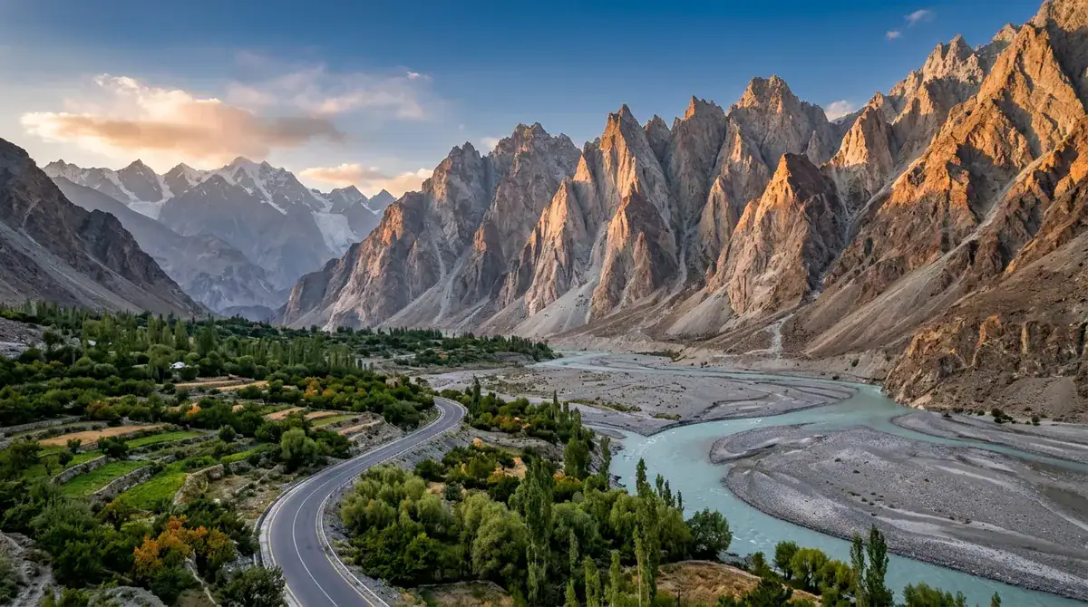
The Passu Cones, also called Passu Cathedral, rise in a jagged row above Passu village in Gojal, Upper Hunza. The Karakoram Highway runs close enough that you can see the spires from a roadside viewpoint without a hike. Most people pull over, set up a camera and wait for morning or evening light to bring out the peaks’ sharp outlines.
Pack layers. Passu village sits around 2,500 metres above sea level, and mornings and evenings stay cold even in summer. May through October offers more reliable weather and road access. Summer is the busiest stretch, while autumn brings clear skies and golden poplars. The drive from Karimabad to the Cones is about 55 km and typically takes 1.5 to 2 hours, though conditions can change the time. For current details, see the official Passu Cones listing.
Once you have your photographs, you can add a walk through the village, a stroll toward Passu Glacier, or a stop at Borith Lake or Hussaini Suspension Bridge. The Cones are a viewpoint rather than a historic site. Climbing them is a technical mountaineering objective, so admire them from the road.
The stop suits photographers chasing golden-hour light, families and older visitors who want a relaxed roadside pause, and anyone building an Upper Hunza day trip around the highway.
At a glance
- Best for: photographers, families and relaxed roadside stops
- Best Season: May to October, with autumn colour in October
- Access by Road: 50 km from Aliabad, about 1 hour 10 minutes by car or jeep
- Suitable For: photographers, families, older visitors and Upper Hunza day trips
Passu Lake and Glacier: Ice and Water Near the Cones
Passu Glacier lies south of Passu village, and its ice comes down so close to the Karakoram Highway that the road seems to lead straight to it. At its snout, a glacial lake collects the meltwater, so blue-grey ice cliffs and still water sit side by side. From the glacier approach, photographers frame those cliffs with the Passu Cones rising behind them, which makes the glacier a natural partner for a visit to the cones.
Getting there is simple. A visitor guide puts the drive from Passu Valley at around 15 minutes. Walking from the Karakoram Highway along village paths, past Borith Lake, takes one to two hours. Once you reach the glacier, you can walk beside the ice, but stepping onto it is a different and riskier activity, because its sides have dangerous sections. A guide is strongly recommended for that. Check road conditions before you drive the upper valley.
The glacier matters beyond its own edges. The Gilgit-Baltistan tourism department links Passu Glacier with Batura Glacier and other glaciers of the Batura Muztagh range, so the ice you see here is part of a much larger mountain system. One local tour operator suggests visiting from April through October and treats the glacier as a day-trip stop.
Photographers suit this place best, along with adventurous walkers and travelers who want a natural stop with a guide option. It works well for slow, unhurried days, and families can enjoy the walk along the glacier edge while leaving the ice to guides.
At a glance
- Best for: glacier and mountain photography, and walks beside the glacier edge
- Best Season: April to October
- Time Needed: a 30 to 45 minute walk from the road to the glacier
- Access by Road: about 15 minutes by car from Passu Valley
- Suitable For: photographers, adventurous walkers and travelers who want a natural stop with a guide option
Batura Lake: A Quiet Glacial Pause
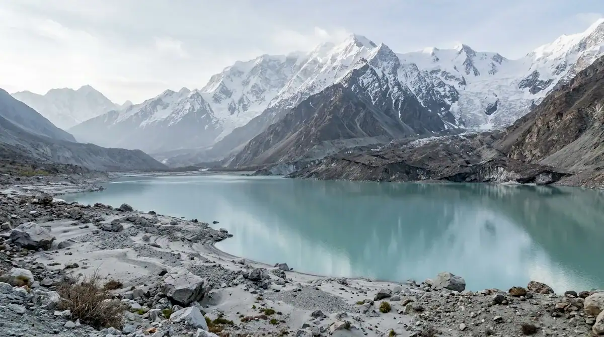
Batura Lake is a quiet pause in Upper Hunza, set near Passu village at the edge of Batura Glacier. Most travelers meet it from the Karakoram Highway, where the road runs past the water after Passu. Pull over, step out and frame the Passu Cones and the glacier peaks rising behind the lake.
This is a roadside viewpoint rather than a planned full stop, so treat it as a short photo break. There is no food, water or accommodation at the lake, so stock up in Passu and bring your own water, snacks and warm layers. The air can turn chilly quickly near the glacier, even on a sunny day.
What makes Batura Lake special is how little it is developed. It is not a historic site, just a still lake with ice and sharp peaks around it. No separate entry price is listed for the lake. That quiet is the reason to stop. Spend a few unhurried minutes watching the light move across the glacier and the mountains.
It suits photographers chasing a clean glacier backdrop, nature lovers and slow travelers who like to stop often on the road. For current drive times from Aliabad to Passu, see the official Gilgit-Baltistan tourism site.
At a glance
- Best for: photographers, nature lovers and slow travelers wanting a glacier backdrop
- Time Needed: a brief photo stop
- Access by Road: roadside viewpoint on the Karakoram Highway after Passu village
- Suitable For: photographers, nature lovers and slow travelers
Borith Lake: Birds, Stillness and the Passu Glacier View
Borith Lake sits at roughly 2,600 metres near Hussaini village in upper Gojal. It is a small, brackish lake, and the official Borith Lake listing presents it as a place to slow down. Come for a shoreline stroll, set up your camera for early-morning light on the still water, and keep an eye on the sky.
Birdwatching is the main draw in spring and autumn. The official page gives March to June and September to November as the periods when migrating ducks, geese and swans pass through, and the lake is an important stopover for them. The water has also shrunk as underground seepage declined, so the shoreline is smaller than it once was.
The road in leaves the Karakoram Highway at Hussaini and climbs about 2 km, steep and narrow. From the lake, a walk toward the Passu Glacier viewpoint takes about 1.5 to 2 hours each way, so the outing fills a half-day. Historically, the Mir of Hunza used the area for winter bird hunting, and a small house built for him is now known as Borith Lake Hotel.
Compared with Attabad Lake, Borith is quieter and more low-key. Expect no jet skis or boat rides here. It suits birders, photographers, walkers and slow travelers, and a local source describes the walk as easy enough for most ages and families.
At a glance
- Best for: birdwatchers, photographers and slow travelers wanting a calm lakeside stop
- Best Season: April to October, with spring and autumn bird migration
- Time Needed: a half day for the lake and the Passu Glacier viewpoint walk
- Access by Road: leave the Karakoram Highway at Hussaini, then tackle the steep, narrow road to the lake
- Suitable For: birders, photographers, walkers and families
Hussaini Suspension Bridge: A Swaying Crossing Over the Hunza River
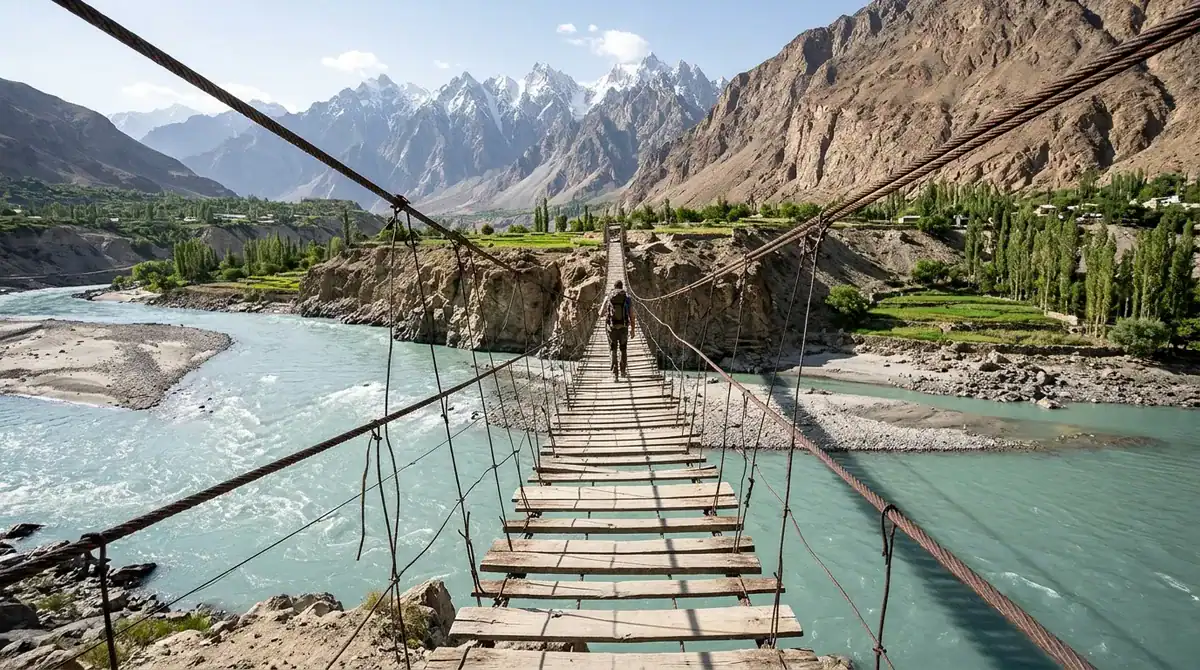
The Hussaini Suspension Bridge is a long wooden footbridge over the Hunza River, near Hussaini village in Upper Hunza. Most visitors start on the approach, where the timber span, the rushing river and the mountain walls make a striking frame for photographs. If you feel comfortable on a swaying crossing, walk out across. The deck moves under each step, so take your time and watch your footing.
The bridge is more than a photo prop. Villagers still use it to reach the far bank, so it remains working community infrastructure, and crossing it means sharing a route people use every day. Borith Lake is a natural extra stop nearby, suited to relaxation, birdwatching and sunset views. Many travelers pair the bridge with a pause at Attabad Lake, so plan a slow, lake-and-village outing.
Peak-season visits can feel busy. A Dawn reporter counted about a hundred tourists at the bridge on a July afternoon in 2021. The same report noted a fee of Rs 100 per tourist, collected to help maintain the bridge and beautify its surroundings, though that was a historical rate.
Weather can change quickly here, so carry warm layers, and be careful in strong wind on the span. Young children need close supervision on the swaying deck. The Tourism Department recommends visiting from May through October. You reach the bridge by road along the Karakoram Highway, so no trek is needed. For current fees, see the official Hussaini village listing.
At a glance
- Best for: photographers and adventure seekers who want a swaying crossing and a village view
- Best Season: May to October
- Time Needed: one to two hours
- Access by Road: directly via the Karakoram Highway, no trek required
- Suitable For: photographers, adventure seekers and slow travelers
Sost: The Last Town Before the Border
Sost is a village and working border town in Gojal, Upper Hunza, sitting at about 2,800 metres on the Karakoram Highway, 184 km from Gilgit. Most visitors come for the practical side of the place: a stop for fuel or a meal, and a look at the dry port, where customs formalities for cross-border goods are handled. It is the last Pakistani town on the highway before Khunjerab Pass.
Sost is a stop, not a sightseeing circuit. The drive from Karimabad takes four to five hours, and customs activity and road conditions can slow your progress, so leave a loose schedule. May through October is the main visiting season, but the Khunjerab road and pass can be affected by snow, and opening dates shift from year to year. Budget little time here unless you are heading across the border.
What makes Sost special is its place on the old trade route. It is a Silk Road town where Wakhi and Burushaski-speaking communities live alongside the trucks, and the official Sost destination page describes the village as peaceful, with warm local hospitality.
Sost suits overland travelers and anyone curious about life on a border. If you are looking for a lake or a historic fort, spend your time further up the valley.
At a glance
- Best for: overland travelers and people curious about border-town life
- Best Season: May to October, the main visiting season
- Time Needed: a short stop, unless you are crossing the border
- Access by Road: on the Karakoram Highway, 184 km from Gilgit, about four to five hours from Karimabad
Khunjerab Pass: Road to the China Border
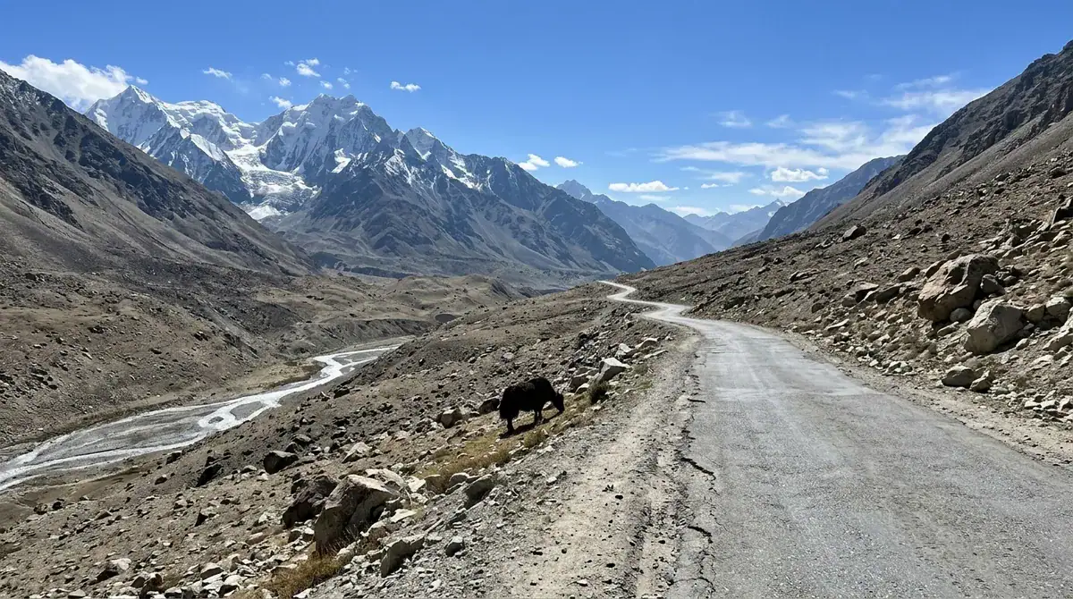
Khunjerab Pass is the highest point of the Karakoram Highway, at 4,693 metres above sea level on the border between Gilgit-Baltistan and China’s Xinjiang region. Reaching it is a full-day outing from Karimabad, with a long drive past Gulmit, Passu and Sost. From Sost, the road runs through Khunjerab National Park, and the alpine slopes and wide valleys along the way are part of the trip.
At the top, the visit centres on the wind-exposed border gate and the mountain scenery. Take your photographs, then keep the stop short and unhurried. The thin air, cold and changeable weather are noticeable even on a bright day, so move slowly and carry warm layers. June through September is the busiest period, but the pass can still be cold and windy in summer. Winter closes it because of harsh weather.
The pass is a paved international crossing, so it gives you a rare sense of standing at the edge of two countries. It suits photographers and experienced high-altitude travelers who enjoy long mountain roads. It is not ideal for anyone with heart or breathing concerns, or for very young children, who may find the altitude and wind hard going. Plan the day around the road, and you will have time to enjoy the view.
At a glance
- Best for: photographers and scenic road-trippers who want a high mountain border
- Best Season: June to September, the warmer months when the pass is open, though it is the busiest period
- Time Needed: a full day from Karimabad, with a long drive each way
- Access by Road: the Karakoram Highway through Hunza and Sost, with the pass closed in winter
- Suitable For: photographers and experienced high-altitude travelers, not ideal for those with heart or breathing concerns or very young children
Khunjerab National Park: Alpine Steppe and Wildlife Drive
Khunjerab National Park is a protected high-altitude landscape in Upper Hunza, along the Karakoram Highway toward the Pakistan–China border. It was established in 1975 to protect alpine steppe habitat and threatened species, including snow leopards, Marco Polo sheep and Himalayan ibex. This is a park of open ground, big skies and mountain roads, not a village walk or a historic site.
A visit is mainly a scenic drive. Stop for photographs of the mountains and the border viewpoints, and keep your eyes on the slopes. Marco Polo sheep and ibex may appear when conditions allow, but sightings are never guaranteed, so treat wildlife as a bonus. Most travelers make it a day trip from Hunza, and the approach from Aliabad covers 175 km, about 3 hours 15 minutes by car or jeep.
Expect very high elevation. Khunjerab Pass sits at 4,693 metres, and a June 2024 visitor review describes snow-covered mountain views and yak sightings while advising warm clothing and short stays at the high stop. Summer is the best season, and the official pass page notes that the pass closes in winter because of harsh weather. Leave spare time in your day, since weather can shift quickly.
Wildlife watchers, photographers and slow travelers will get the most from this park. Its alpine steppe and threatened animals set it apart from the forts and villages lower in the valley.
At a glance
- Best for: wildlife watchers, photographers and slow travelers
- Best Season: summer, as recommended by the Pakistan Tourism Development Corporation
- Access by Road: 175 km from Aliabad, about 3 hours 15 minutes by car or jeep, combined with the Khunjerab Pass drive
- Suitable For: wildlife watchers, photographers and slow road-trippers
Nagar Valley: Glaciers and Villages Across the River
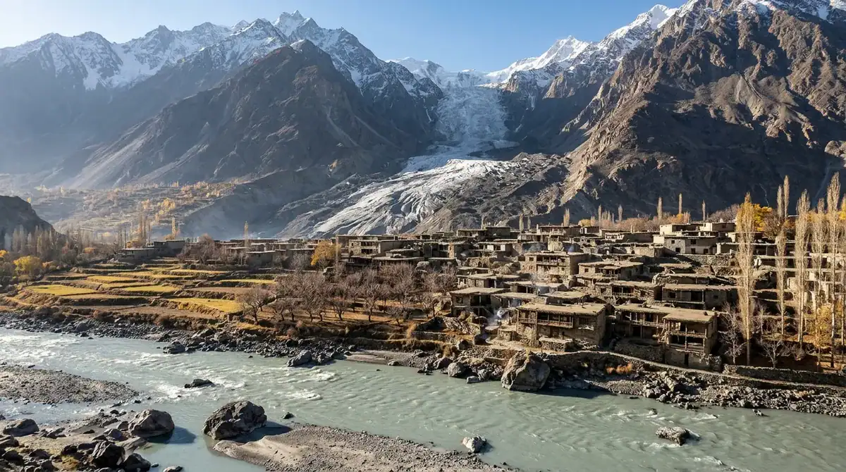
Across the Hunza River lies Nagar, a mountainous district with glaciers, fertile valleys and a past as a princely state. Its Silk Road history and gemstone deposits of ruby, topaz, aquamarine, emerald and quartz give it an identity of its own within Gilgit-Baltistan. The official Nagar district page sets out this heritage, and it is a good starting point for planning.
Begin at the roadside Rakaposhi viewpoint, then slow down in the villages and follow the lanes toward the Hopar Glacier. For a longer day, the Hopar Valley hike is a seven-hour return route of medium difficulty that crosses the glacier toward Hander. Jeeps are the usual way into Hopar and the other side valleys, because public transport becomes less frequent once you leave the Karakoram Highway, which follows the valley’s lower side.
Nagar is quieter and less visited than Hunza, according to one Nagar travel guide, and that calm is part of its appeal. Spring, summer and early autumn bring the clearest mountain views, but weather in the peaks can change quickly, so keep a spare day in your plans.
Photographers, slow travelers and anyone wanting to explore beyond Karimabad will find plenty here.
At a glance
- Best for: photographers, slow travelers and those wanting to explore beyond Karimabad
- Best Season: spring, summer or early autumn
- Time Needed: seven hours return for the Hopar Valley hike
- Access by Road: the Karakoram Highway along the lower side of the valley, with jeeps for Hopar and the side valleys
- Suitable For: history-minded visitors and anyone seeking a quieter valley
Hoper Glacier: Debris-Covered Ice Beside Hopar Village
Hoper Glacier, also called Hopar or Bualtar Glacier, lies beside Hopar village in Nagar Valley, just across the Hunza River from Karimabad. Most visitors start in the village, where you can look out over the debris-covered ice and the snowcapped ranges beyond it. The official Nagar district guide describes Hoper Valley as a place of snow-capped mountains and a continuous glacier, and that is exactly what you see from the village edge.
The more demanding option is the crossing to Hander. The government trekking brochure lists it as a medium-grade, seven-hour return hike over the glacier, with views of Miar Glacier, Miar Peak and Molobiting Peak. Hopar sits at about 3,000 metres, so set a steady pace from the start. If your fitness is limited, the village viewpoint gives you the glacier and peaks without the long walk.
Getting there takes some planning. Hopar is about 10 km from Nagar Khas by road, and the approach can be rough, so a local jeep or taxi may be needed. The village is also a starting point for treks to Barpu Glacier and Rush Lake, which makes it a useful base for longer days in the mountains. A Hopar Glacier guide recommends June through October for visiting.
At a glance
- Best for: glacier views from the village, and the Hander crossing for experienced hikers
- Time Needed: about seven hours return for the Hander crossing
- Access by Road: rough approach from Nagar Khas, so arrange local transport in advance
- Suitable For: photographers, hikers and travelers on a day trip from Hunza
Patundas Meadows: High Pasture Between Two Glaciers
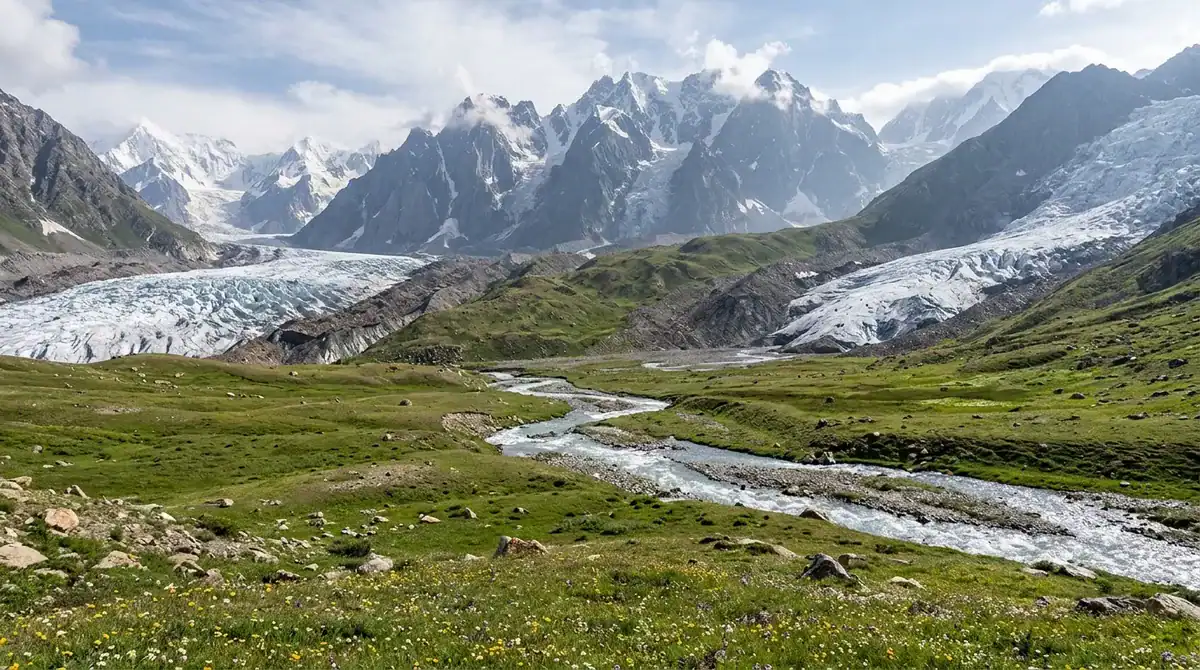
Patundas Meadows is a high pasture on a ridge between the Passu and Batura glaciers, and you reach it on foot rather than from a roadside pull-off. The route usually starts at Passu on the Karakoram Highway or at Borith Lake, and it takes about three days from Passu. Walkers cross the Passu Glacier with a local guide, climb to the meadow at roughly 4,100 metres, camp, and spend time at the ridge viewpoints, where broad Karakoram views open in every direction.
The route is demanding, and the glacier crossing is the hardest section. Conditions change as the ice shifts and the weather turns quickly, and nights stay freezing even in summer, so pack for cold. Trekking in Gilgit-Baltistan means walking below 6,000 metres, and May through October is the trekking season. Restricted-area treks require a permit, a licensed guide and a porter, and trekking and mountaineering activities must be registered. The Gilgit-Baltistan trekking listing includes the Patundas trek among its multi-day routes across glaciers and high passes.
What sets the place apart is its position. Few walks let you stand between two major glaciers in one camp, with ice on either side and peaks rising beyond. There is no standalone entry fee, and operators quote trek packages according to group size and dates.
This is a route for fit, acclimatized trekkers who go with a local guide, and for photographers who want ridge light and glacier scenery. It is not an easy family outing.
At a glance
- Best for: fit, acclimatized trekkers and photographers who want glacier and ridge views
- Best Season: May to October, the government’s trekking season
- Time Needed: about three days on foot from Passu
- Access by Road: start from Passu on the Karakoram Highway or from Borith Lake, then walk
- Suitable For: experienced trekkers with a local guide, not families seeking an easy outing
Nanga Parbat View Point: Roadside Giant Across the Gorge
Pull over at Talechi, also spelled Thalichi, for one of the most striking views on the Karakoram Highway. The stop sits in Diamer District, not in Hunza Valley, about 12 km north of Raikot Bridge on the road between Chilas and Gilgit. From the roadside, you look across the Indus gorge to the northern side of Nanga Parbat, rising above the river valley. Many travelers take a tea break here as well as a photo stop.
This is a brief stop, not a village walk, lake visit or historic site. A visitor guide describes it as a free roadside stop where you pay only for any refreshments you buy. Give yourself 15 to 30 minutes, which is usually enough to take photographs and enjoy a cup of tea.
What makes Talechi special is how much mountain you see without leaving the car. Gilgit-Baltistan’s tourism department calls Nanga Parbat a major attraction of Diamer, and here the peak is visible from the road itself, with no trek required. A regional guide lists May to June and September to October as the best months, but cloud and haze can soften the view, so keep a spare moment for the light to change. It suits photographers, families, travelers who cannot manage a hike and road-trippers building a northbound itinerary.
At a glance
- Best for: photographers and road-trippers wanting a major peak view without a trek
- Best Season: May to June and September to October, when cloud and haze are often lighter
- Entry Cost: free roadside stop, with payment only for refreshments; see the official Diamer district page for current details
- Time Needed: 15 to 30 minutes
- Access by Road: on the Karakoram Highway at Talechi, about 12 km north of Raikot Bridge
Naltar Valley: Forest, Meadows and Coloured Lakes
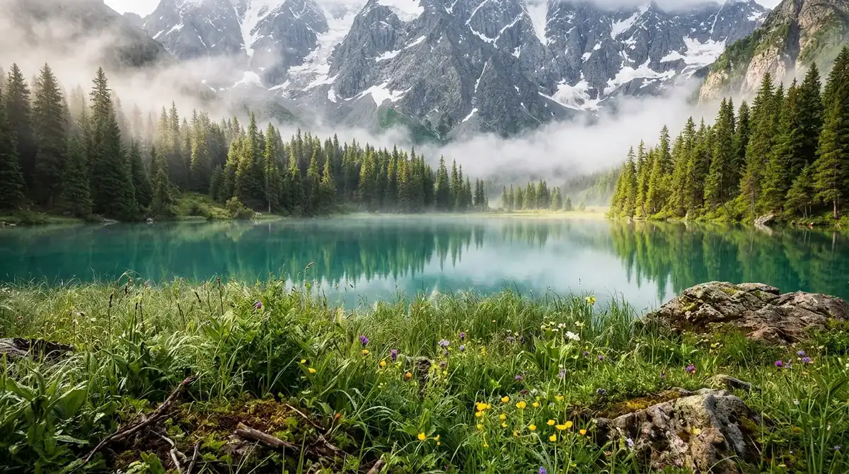
Naltar is a forested valley reached from Gilgit via Nomal, so a trip here feels like a detour from the dry, rocky country around the city. The main outing is a jeep ride to the Bashkiri Lakes, where Satrangi, Blue and Feroza lakes sit among the pines. Satrangi’s water shifts between green, turquoise and blue, so photographers can spend a long time working the light. The official tourism listing for Naltar also highlights a viewpoint, forest hikes and the local bazaar.
Plan on a full day from Gilgit. The 12 to 13 km track from Naltar Bala to the lakes calls for a 4×4 jeep, and the track can be slippery after heavy rain. Allow at least an hour at the lakes, or half a day if you add a lakeside walk and a picnic. The lakes sit between about 3,050 and 3,150 metres, so evenings turn cool, and summer weekends and Pakistani holidays are the busiest times.
Naltar stands out for its combination of alpine forest, colourful water and meadows. Mid-June to mid-October is the lake season, and late September to mid-October brings autumn colour and fewer visitors. In winter, January to March brings snow and a ski area, though heavy snow can cut off vehicle access. Families looking for easy lakeside walks, photographers and winter-sport travelers will find the most here.
At a glance
- Best for: photographers, families seeking easy lakeside walks and winter-sport travelers
- Best Season: mid-June to mid-October for the lakes, with autumn colour from late September; January to March for skiing
- Time Needed: a full day from Gilgit, with at least an hour at the lakes
- Access by Road: from Gilgit via Nomal, then a 12 to 13 km jeep track to the lakes
- Suitable For: families, photographers and winter-sport travelers
Ganish Khun Historical Village: A Living Heritage Settlement
Ganish Khun is a living village in Lower Hunza, just off the Karakoram Highway near Aliabad. Walk its lanes past restored mosques, old watchtowers and heritage houses, and ask a local guide to explain how the settlement was laid out. The conservation work restored four mosques and the jataq, a communal space, and the village also keeps remaining fortification towers and gates, a community pond and a village guesthouse. Photograph the architecture from the lanes, but ask before aiming a lens at doorways or people, because families live inside these homes.
Ganish sits about 5 km from Karimabad and can be reached by local transport or a hired car. At roughly 7,500 feet, the village is high enough to make steady, unhurried walking the best pace. The Gilgit-Baltistan tourism listing for Ganish recommends April through October for sightseeing, and describes winter visits as colder and quieter.
The Sacred Haldekish Rocks, also part of Ganish’s heritage, are best located with help from a local guide.
What sets Ganish apart is that it is an inhabited historic community with conserved architecture. Here you see people still living within the old layout, not a fort or museum preserved behind glass. History lovers, cultural walkers, photographers, slow travelers and families interested in heritage will find the most to enjoy.
At a glance
- Best for: history lovers, cultural walkers and photographers wanting a living village
- Best Season: April to October, the ideal sightseeing period
- Access by Road: about 5 km from Karimabad, reached by local transport or a hired car
- Suitable For: history lovers, slow travelers and families interested in heritage
Ghalapan Apricot Gardens: Orchards in Upper Gojal
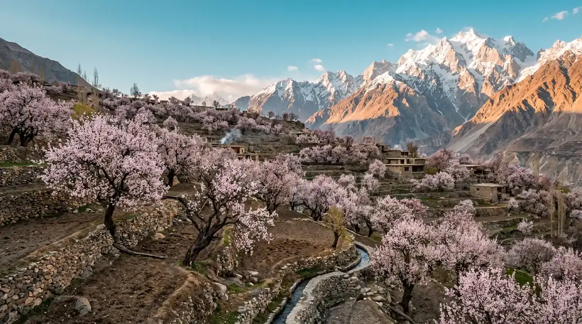
Ghalapan sits along the Karakoram Highway in Upper Gojal, at about 2,700 metres. The Khunjrab Villagers Organization describes it as a village of terraced fields with views of snow-capped peaks, and the apricot gardens are listed among the places to see there. The main reason to stop is the scene itself: step out of the car, frame the terraces and orchards against the high peaks, and take your time with the light.
Spring is the season that gives the gardens their character. A regional blossom guide places flowering in Gojal villages in the second half of April, though the timing shifts with the weather. When the trees bloom, the orchards add a soft colour to the grey-brown slopes. Autumn brings a different palette to the same terraces, so the village looks new when you return later in the year.
The orchards are private land, so ask permission before you walk in among the trees. The same blossom guide warns that the named gardens should not be treated as open public walks. Little detail is documented about the gardens themselves, so treat the visit as a roadside and village-edge stop rather than a planned attraction.
Ghalapan suits photographers, slow travelers and anyone visiting in blossom season who wants a quiet village among terraces and peaks.
At a glance
- Best for: photographers, slow travelers and blossom-season visitors
- Best Season: second half of April for blossom, with autumn colour afterwards
- Access by Road: along the Karakoram Highway in Upper Gojal, at about 2,700 metres
- Suitable For: photographers and slow travelers who enjoy a quiet village stop
Season, Roads and Safety Checks Before You Go
Timing comes first. The government’s trekking season runs from May through October, and the Pakistan Tourism guide map defines trekking as walking below 6,000 metres. Winter is a different trip. The Khunjerab Pass closes during the cold months, so build your plan around the routes you most want to drive, and keep the high passes for the warmer half of the year.
Roads need the same attention. Monsoon 2025 damaged 15 houses and 2 bridges in Hunza district, so check conditions with your driver, guesthouse or guide on the morning you travel, and keep a spare day in your itinerary.
Altitude sets its own pace. Mornings stay cold even in summer, and the air feels thin above Passu and on the climb toward Khunjerab. Weather can also turn quickly, bringing cloud, wind or sleet to a sunny viewpoint. Spend your first day or two at a gentle pace, drink plenty of water and climb stairs slowly until your breathing settles.
A licensed guide is worth the cost. Restricted-area treks require a permit plus a licensed guide and porter, and it makes sense to hire a local guide for glacier walks and for visits to remote villages, where paths are unmarked and the weather is hard to read.
Save the emergency number before you leave your base. The Gilgit-Baltistan tourism emergency page lists 05813-1422 as the Tourist Police hotline for Hunza, so store it in your phone along with your hotel’s address.
Building Your Hunza Days: Day Plans, Food and Where to Stay
Your first day can stay close to Karimabad. Climb to Baltit Fort in the morning, walk down to Altit Fort in the afternoon, and finish at the bazaar for woollen goods and dried fruit.
Set an alarm for the second day. Drive up to Duikar in the dark, watch the sun light the Hunza and Nagar valleys from Eagle’s Nest, then spend the late morning walking the village lanes between terraced fields.
For the third day, drive the Karakoram Highway north. Stop at Rakaposhi View Point at Ghulmet for the mountain, then follow the road past Attabad Lake, where you can take a boat out or enjoy lunch on the shore. On the way back, cross the Hussaini Suspension Bridge, and walk slowly, since the deck sways underfoot.
The fourth day is the longest, so start early. Photograph the Passu Cones from the road as the light turns gold, walk toward Passu Glacier, and finish at Borith Lake, where migrating birds pass through in spring and autumn.
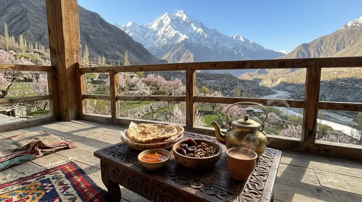
Food in the valley is simple and seasonal. Taste apricots and dried fruit at the bazaar, then try local bread with a cup of salted tea at one of the cafés around Karimabad, where a window seat often comes with a mountain view. If you have dietary needs, tell your hotel and café before you arrive, because menus are short and kitchens may not have many substitutes.
Book your Karimabad room early if you travel in June to August, when the town is busiest. Compare rooms by walking distance to Baltit Fort and the bazaar, and if you visit in winter, check how easily a car or jeep can reach the hotel on steep, snowy lanes.
Plan Your Hunza Trip Around the Road and the Season
Start by choosing your month and one anchor for the trip. For the forts, Attabad Lake and Duikar, April to October is the window, and a spare day in Karimabad gives you room if a stretch of the Karakoram Highway closes. If glaciers and ridges are the draw, pick trekking dates between May and October, then book a licensed guide and porter before you arrive, because a restricted-area trek cannot go ahead without them.
Next, sort your must-see stops into days. Give the Khunjerab Pass its own day, since the high road is long and the pass shuts in winter. Pair the Passu Cones with Borith Lake, which sit on the same stretch of road and make a natural half-day loop.
Before each morning on the road, ask your driver, guesthouse or guide about conditions on the route you plan to take. Pack warm layers even if the afternoon feels mild, and carry enough water for the drive, because roadside shops thin out north of Karimabad.
Finally, save the Tourist Police hotline in your phone, write your hotel’s address in English and Urdu, and share your day plan with someone back home. Then sketch a rough route on paper and leave one open afternoon, so the valley can set the pace.